MTB Routes around Ripoll
Pedal around Ripoll
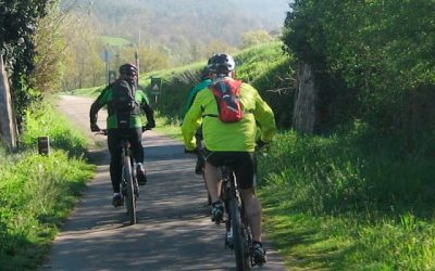
The Iron and Coal Route
It forms part of the Vies Verdes network, and is ideal to explore on foot or by bike. It follows the route of the old railway line: Ripoll – Sant Joan de les Abadesses (Toralles).
Difficulty: low
Elevation change: 100 metres, approx.
Route: 12 km (paved)
Facilities: stretching areas, litter bins, seating, fountains, restaurants and bars along the route.
This route shares the initial section of route number 7, until it forks off in the direction of the summit of El Catllar. A few metres off the trail, you can enjoy the views from the top of El Catllar and visit the architectural complex, made up of the church and hermits’ house dating from the 11th–19th centuries. Back on the trail, you begin the descent towards Ripoll, following the river until reaching the centre of Ripoll and then returning to Can Guetes, the starting point of the route.
Highlights of this route include the fountain of the three planes and the Tòtil fountain, as well as the visit to the town of Ripoll.
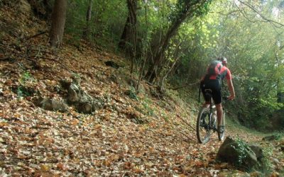
Sant Bernabé de les Tenes
Starting point: The Iron and Coal Route
Route number: 2
Difficulty: Red (hard)
Cumulative elevation change: + 490 metres
Route: 24 k
Approximate time: 3 hours
This is a long route, mostly made up of woodland tracks and trails that run through the forest.
You set off towards Ripoll. Shortly before reaching Ripoll, you turn off to the left to follow the path of the Carboneres stream until reaching the N-260. You then go down a paved track towards the church of Sant Bernabé (founded in the 15th century). You need to go a few metres off the track to visit it. Head down the trail until the Vallfogona stream. This is a section of the old highroad that ran from Vallfogona to Ripoll.
Go up the Tolosa bridge to the Samala bridge and then follow the route in the direction of Sant Joan de les Abadesses along the Les Llances track. You cross the town and arrive back at the starting point.
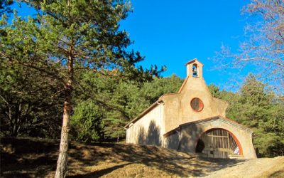
El Remei
Starting point: Ripoll-Can Guetes car park
Route number: 7
Difficulty: blue (medium)
Cumulative elevation change: +130 metres
Route: 7 km
Approximate time: 1 hour
This is a short and easy route. Following the sign posts, you will cross the town of Ripoll. You continue towards Calatrava bridge along the walkway parallel to the river Ter. You pass through the Castelladrall residential area and link up with the Agafallops path that joins the Solana bike path parallel to the C-17 until reaching the junction with the C-26. Go up the paved track until the detour that takes you to the hermitage of Remei, where a gathering is held in October. The descent follows a forest track to the Ciutat Jardí neighbourhood of Ripoll, where you cross the road and go through Ripoll back to Can Guetes, the starting point of the route.
We highly recommend you make a stop in the town of Ripoll, cradle of Catalonia, and visit the Monastery of Santa Maria de Ripoll, the Scriptorium and the Palau Forge, an unbeatable setting surrounded by the rivers Ter and Freser.
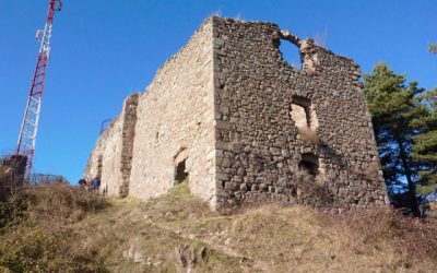
El Catllar
Starting point: C-26 Les Llosses – Berga
Route number: 8
Difficult: black (very hard)
Cumulative elevation change: +420 metres
Route: 15 k
Approximate time: 2 hours
This route shares the initial section of route number 7, until it forks off in the direction of the summit of El Catllar. A few metres off the trail, you can enjoy the views from the top of El Catllar and visit the architectural complex, made up of the church and hermits’ house dating from the 11th–19th centuries. Back on the trail, you begin the descent towards Ripoll, following the river until reaching the centre of Ripoll and then returning to Can Guetes, the starting point of the route.
Highlights of this route include the fountain of the three planes and the Tòtil fountain, as well as the visit to the town of Ripoll.
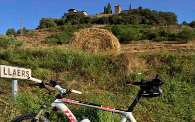
Llaés
Route 19 on the map
Starting point: Ripoll (Can Guetes car park)
Time: 4 hours – Km: 35
Elevation change: 710 m
Route 19B on the map
Time: 3 hours – Km: 21.27
Elevation change: 476 m
Route 19 on the map
A route through the south-eastern sector of Ripoll, through the mountain of Sant Antoni and the entire Llaés sector, arriving at the Vallfogona stream and joining a section of Route 2 of the MTB Centre until the Samala bridge. From here, the route goes up to Raurés, and you then go down the track to Rodonella and link up with the Iron and Coal Route (also Route 2), and come back to the starting point at the Can Guetes car park.
This route allows you to cover a large area, with a wide variety of landscapes, as well as different tracks and trails.
Route 19B on the map
There is also the possibility to follow a complementary and optional black level route (b), which would link Les Terrades and Sant Antoni (by trail) with Route 2 of the MTB Centre, allowing you to rejoin the current route to the Sant Eudald Hostel, at the Vallfogona stream, under the Samala bridge. This is a way of connecting the routes, giving you different alternatives and allowing you to combine various difficulties and distances.
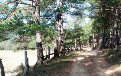
L’Auró
Route 20 on the map
Starting point: Ripoll (Can Guetes car park)
Time: 3 hours – Km: 30.60
Elevation change: 415 m
Route 20B on the map
Time: 2h 45m – Km: 22.10
Elevation change: 400 m
Route 20 on the map
A route that runs through the north-western sector of Ripoll, cutting through a small part of the municipalities of Les Llosses and Campdevànol, surrounding the El Catllar range. The route, which coincides with the black Route 8 at the beginning, and which passes along a fairly good forest track, reaches the Vilardell mills before climbing up to L’Auró, with the farmhouse and fields. The route continues to the hermitage of Sant Feliu d’Estiula and goes down the Torrent de la Cabana until it crosses the Merdàs river and joins the Camí Ral i Ramader de Campdevànol. Follow it to the neighbourhood of La Creu where, after crossing the Merdàs again, you climb up to Estiulella and the Coll de Vilar, descending towards the Tòtil fountain and reaching Ripoll. Cross the town to end the route at the Can Guetes car park.
Route 20B on the map
There is also the option to follow a complementary and optional black level route (b), which would link the Collet de l’Auró with the Collet del Vilar, entirely by trail, passing through the Emprius. The length of the route is considerably shortened. Follow the white and green signs of a local path in Campdevànol.
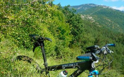
L’Adroguer
Route 21 on the map
Starting point: Ripoll (Can Guetes car park)
Time: 2h 30m
Km: 17.80
Elevation change: 405 m
Route 21B on the map
Time: 2h 45m
Km: 19.75
Elevation change: 455 m
Route 21 on the map
A high-difficulty route through the north-eastern sector of Ripoll, going around the entire sector of Rama and Sant Roc. You follow the route of the old Sant Joan highroad to Rama and Puntes de Rama, where you begin the steep climb to the ruins of L’Adroguer, climbing the last metres on foot. Enjoy magnificent panoramic views of Sant Amand, Puig Estela, Serres de Milany and Santa Magdalena, …
On the descent, you can take advantage of the fairly well maintained and smooth path that follows the ridge. This is the path that goes down from Vidabona, through the Collet d’en Lleona, Collet de Camp Roig, L’Adroguer, Camí de Saltor, Pla de l’Home Mort and the Collet de Baups. From the Baups pass, go up to the top of Sant Roc, a true balcony vantage point over the town of Ripoll. Down from the cemetery, cross the Sant Joan road, the new bridge over the Ter and end the route at the Can Guetes car park.
Route 21B on the map
There is also the option to follow and complementary and optional black level route (b), which would link L’Adroguer with the Collet de Camp Roig, entirely by trail, following the track to the Baups pass.
